Italy’s landscapes tell a story written in stone — a spectacular fusion of volcanic fire, glacial ice, and marine erosion. From the Dolomites’ pink spires to Sicily’s glowing craters, every corner of the peninsula reveals how nature has shaped Italian identity. Traveling through these sites means not just admiring their beauty but understanding the country’s deep geological heritage. Whether you are an amateur geologist with a hand lens or a curious traveler in sturdy walking shoes, Italy’s rock formations invite you to see the land itself as a living museum.
Go to the section
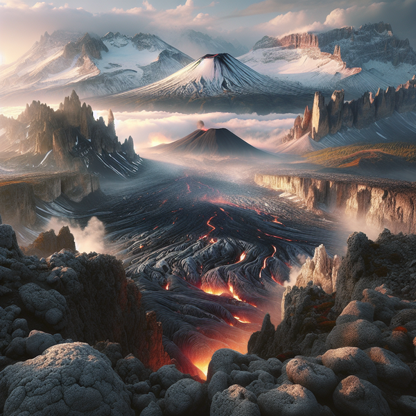
ToggleVolcanic Wonders of Southern Italy: Etna, Stromboli, and Vesuvius
Sicily’s Mount Etna, Europe’s tallest active volcano at over 3,300 meters, dominates the skyline east of Catania. The road SP92 climbs past fields of lava, chestnut forests, and ancient vineyards — an ascent that tells you exactly why UNESCO called Etna a site of exceptional global value. Travelers can join guided hikes from Rifugio Sapienza, where cable cars and off-road jeeps bring you within safe proximity of fuming craters. Even at lower levels, you’ll find ribbons of solidified lava from eruptions past, a geological timeline hardened underfoot.
From the Aeolian Islands’ port of Milazzo, hydrofoils reach Stromboli in just under two hours. The island’s persistent eruptions earned it the nickname “Lighthouse of the Mediterranean.” Local guides lead twilight hikes up the Sciara del Fuoco, where glowing red ejecta arcs into the night — a sight that rivals any fireworks display but runs entirely on planetary power. Stromboli’s activity has been recorded continuously for centuries, making it a natural laboratory for volcanology.
Further north near Naples, Mount Vesuvius rises above the Bay of Naples in deceptive calm. The Gran Cono trail reaches the summit rim in about 30 minutes of steady climbing, rewarding visitors with views across Pompeii’s ruins and Capri’s distant outline. Walking along Vesuvius’ crater rim reminds you that this mountain once reshaped history, and that its geology remains active beneath the vineyards of Lacryma Christi wine.
The Dolomites: Italy’s Fossilized Coral Mountains
The Dolomites, part of the Northern Italian Alps, differ strikingly from the rest of Italy’s mountain ranges. Their rock — dolostone, a calcium magnesium carbonate — was once ancient sea coral uplifted above today’s alpine meadows. The most dramatic formations tower around Val Gardena, the Sella Massif, and Tre Cime di Lavaredo. The Dolomites glow a surreal pink during alpenglow (known locally as enrosadira), an optical spectacle that photographers eagerly chase from viewpoints like Passo Giau near Cortina d’Ampezzo.
For geology-minded walkers, the Bletterbach Canyon near Aldino is a must. Sometimes called “Italy’s Grand Canyon,” it exposes sedimentary layers stacked like a history book, from volcanic tuffs to fossils of prehistoric plants. Well-marked trails with interpretive panels make this UNESCO Geopark approachable even for families with older children. Summer chairlifts also make accessing high plateaus such as Alpe di Siusi remarkably easy, and the rifugi that dot these slopes offer hearty polenta with mushrooms after a day’s exploration.
If you venture deeper into South Tyrol, the Dolomites around Val di Funes host the jagged Odle Group, visible behind the tiny church of Santa Maddalena. It’s a rare case where geological structure dictates postcard perfection — the dolomitic cliffs frame the village like theatrical scenery sculpted by ancient seas.
Karst Landscapes and Cave Systems of the Trieste Plateau
Bordering Slovenia, the limestone plateau above Trieste gives its name to a global phenomenon: karst topography. This region coined the term thanks to its sinkholes, disappearing rivers, and vast underground networks. The Grotta Gigante, reachable from Trieste in under 20 minutes by car or bus 42, contains one of the world’s largest underground chambers open to visitors — 114 meters tall and lit to highlight its monumental stalactites. The guided descent covers 500 steps down and then back up, so wear grippy shoes.
Nearby, the tiny village of Basovizza sits above a series of dolines — funnel-shaped depressions caused by water erosion in soluble limestone. Trails lead toward the Gropada caves, where local speleology groups sometimes organize tours for small groups. Bring a jacket even in summer: cave temperatures hover around 11°C year-round. This region’s karst hydrology also feeds Trieste’s drinking water, making it an instructive example of geology meeting urban life.
The Tectonic Sculptures of Central Italy: Gorges and Gullies in Tuscany and Lazio
Central Italy’s softer sedimentary layers tell a quieter story of erosion and tectonic uplift. Around Siena and Pitigliano, volcanic tuffs have been carved into dramatic gullies known as calanchi. The elevated town of Civita di Bagnoregio, nicknamed “the dying city,” perches on one such eroding plug of rock, its base slowly crumbling as wind and rain wear away the clay beneath. A pedestrian bridge provides modern access, though it sways slightly if crowded — a small reminder of the impermanence of Italy’s geology.
Nearby in the Tuscan countryside, the Biancane Geothermal Park in Monterotondo Marittimo offers walking trails through steaming vents and bubbling mud pools. These fumaroles mark an area where the crust thins, allowing gases to escape from deep geothermal reservoirs harnessed by the region’s power stations. The contrast between white chalky soil and green scrubland makes for peculiar photography conditions: your lens might fog from sulfur vapor if you stand too close.
In Umbria–Lazio borderlands, gorges like the Nera River valley near Narni display folded limestone cliffs shaped by millions of years of tectonic compression. Kayaking through these narrow canyons reveals rock strata stacked diagonally like pages in a tilted book. It’s a quieter adventure compared to volcano climbing but equally revealing of Italy’s dynamic crust.
Southern Coasts and Sea Caves: From Calabria to Puglia’s White Cliffs
Heading south, the Arco Magno near San Nicola Arcella in Calabria offers a sea-carved archway opening into a turquoise inlet accessible by a short rocky path. Arrive at low tide and you can walk into the enclosed beach beneath the natural arch — a prime example of coastal erosion sculpting a perfect amphitheater. Snorkelers often trace the limestone walls to glimpse marine fossils embedded just under the waterline.
In Puglia, the Adriatic coast around Santa Maria di Leuca hosts the Grotta del Soffio, reachable by small boat tours departing from the marina. As sunlight filters through underwater openings, the entire chamber shimmers with an emerald glow. Geologists point out that these karst formations continue the same limestone system found in Trieste, proof of how continuous Italy’s geological backbone really is. Along the cliffs of Polignano a Mare, erosion produced stacked terraces where homes now cling perilously over the blue void — a fusion of human and geological architecture.
Further north along the Gargano Peninsula, the sea stacks near Vieste rise like marble sentinels from shallow turquoise waters. The Pizzomunno sea stack, about 25 meters tall, owes its survival to differential weathering — harder rock resisting the erosion that crumbled its neighbors. Morning light is best for photos when shadows carve depth into the stone texture.
Sardinia’s Primeval Rocks and Inland Formations
While Sicily flaunts volcanoes, Sardinia preserves some of Europe’s oldest rock. The island’s granite and metamorphic outcrops date back over 500 million years, predating the Alps themselves. The Gennargentu Massif around Fonni and Desulo demonstrates this ancient core, where schist and quartz veins gleam amid high pastures grazed by Sardinian sheep. Hike the trail to Punta La Marmora, at 1,834 meters, to grasp how erosion has rounded these once-mighty mountains into domes.
On Sardinia’s east coast, the Golfo di Orosei conceals dozens of sea caves accessible only by boat or kayak, most famously the Grotta del Bue Marino. This cave stretches for several kilometers inland, decorated with stalactites shaped by both freshwater and marine infiltration. Tours depart from Cala Gonone harbor, usually lasting about 90 minutes, with boat captains explaining local legends attached to each chamber.
Inland, near the village of Ulassai, the limestone escarpment known as the Tacchi d’Ogliastra rises in white cliffs reminiscent of miniature table mountains. Rock climbers love the area for its solid vertical routes, but even non-climbers can appreciate panoramic viewpoints like Scala di San Giorgio, where narrow gorges split the plateau into striking geometric shapes.
The Sicilian Coastline Beyond Volcanoes: Sea Stacks and Cliffs of the South
Beyond Etna’s dominance, Sicily’s coastline offers geological drama of a different sort. Near Agrigento, the Scala dei Turchi gleams pure white against the Mediterranean. Its stair-like marl formation results from compressed clay and limestone, smoothed by wind and salt spray. Visitors often remove their shoes to feel the chalky surface, though local authorities periodically restrict access to preserve the fragile strata. It’s an otherworldly landscape just a 15-minute drive from the Valley of the Temples, demonstrating how human history and natural forces continually collide in Sicily.
Further west, the Zingaro Nature Reserve near San Vito Lo Capo contains cliffs and coves formed by fault lines that extend offshore into the Tyrrhenian Sea. Trails linking Cala Tonnarella and Cala Marinella follow rugged terrain where limestone meets deep blue water. You can spot breccia along the path — angular rock fragments cemented by time — tangible signs of seismic activity frozen in place.
In contrast, the basaltic columns of Acitrezza, known as the Faraglioni dei Ciclopi, formed from ancient submarine eruptions. Local legend ties them to Homer’s Cyclops, but their true origin lies in cooling lava that fractured into hexagonal shapes like a natural mosaic. Small fishing boats circle the stacks daily, offering a perspective that underscores just how sculptural Italy’s coastline can be.
Practical Tips for Visiting Italy’s Geological Formations
When planning trips around Italy’s geological sites, always check safety restrictions and local guide availability — particularly if venturing near active volcanoes or sea caves. National parks such as Parco dell’Etna and Parco delle Dolomiti Bellunesi have clear signage and updated trail conditions on their official websites. Dress for altitude and terrain: sturdy boots, layered clothing, and at least one liter of water per person are standard across most hikes. In karst or cave environments, bring a headlamp and respect regulations about touching mineral formations.
For those traveling without a car, regional trains and buses often connect base towns like Catania, Cortina, and Trieste to the starting points of geological attractions. Apps such as Trenitalia and Itabus show current schedules, while local tourism boards can suggest guided excursions in English. Visiting multiple regions allows you to see Italy’s entire tectonic narrative — from the African plate pushing beneath the Eurasian one in the south to the uplift of the Alps in the north.
Above all, approach these landscapes with the curiosity of a student rather than the entitlement of a tourist. Every rock, ridge, and crater holds evidence of how this peninsula became the Italy we know today — beautiful precisely because it never stops evolving.